I shall be telling this with a sigh
Somewhere ages and ages hence:
Two roads diverged in a wood, and I—
I took the one less traveled by,
And that has made all the difference.
Robert Frost “The Road Not Taken” – 1915
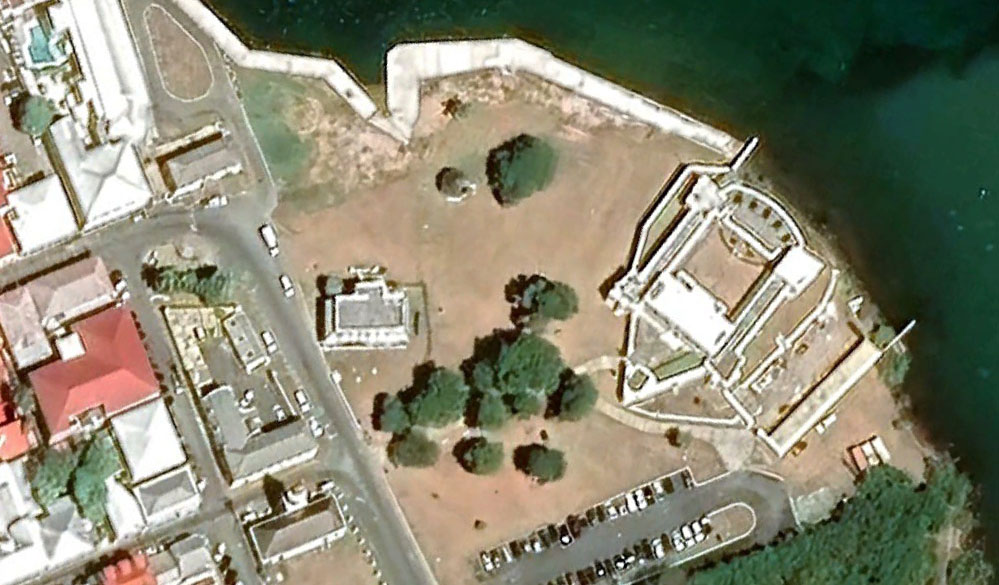
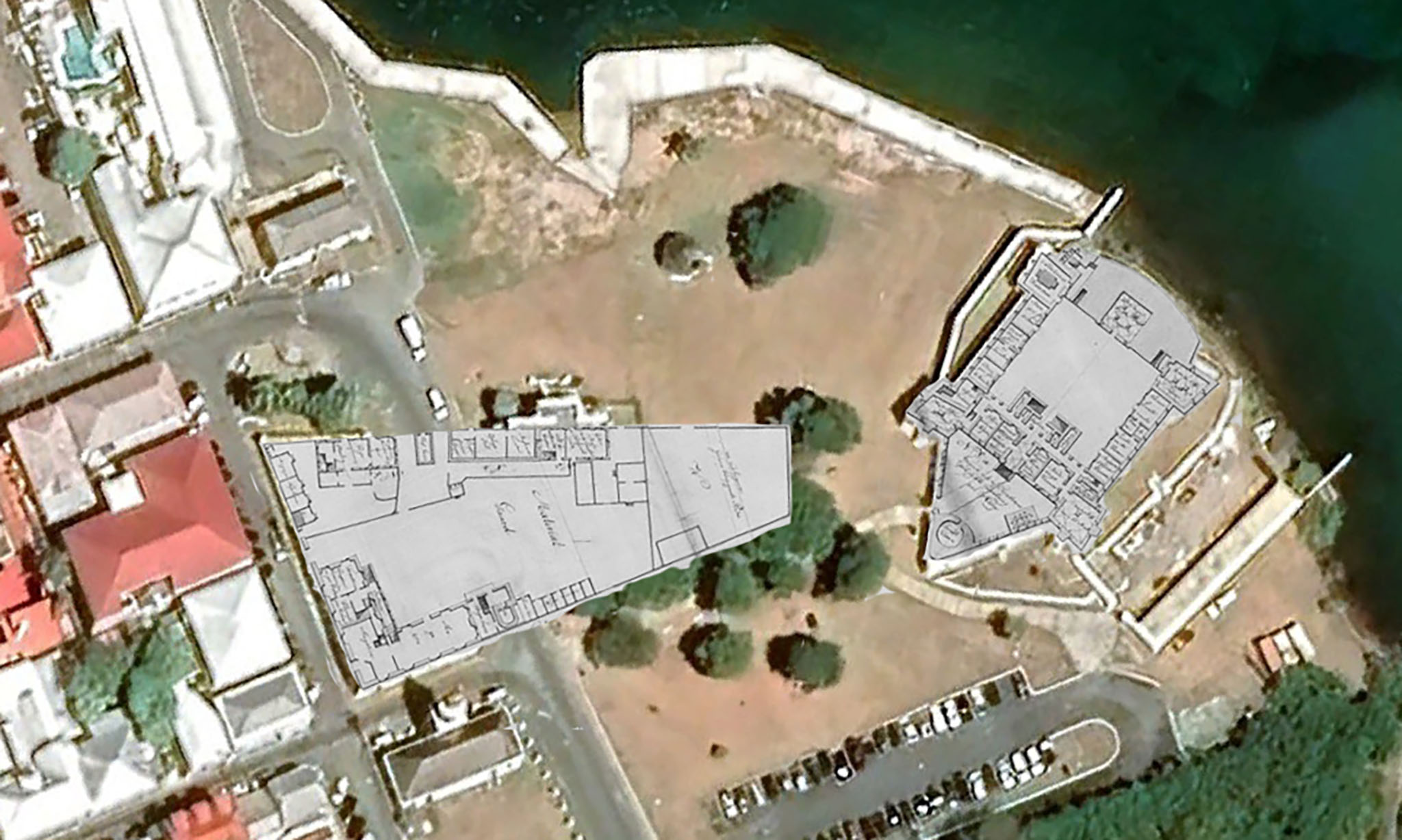
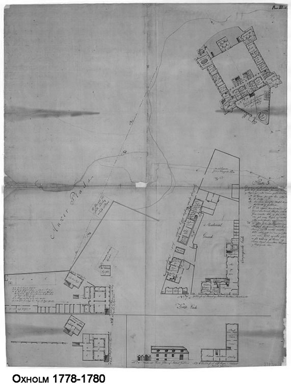
Odd, the above image may look, but it is a fragment of the Oxholm map of the Danish West India and Guinea Company Warehouse, Materials Yard, and Fort Christiansvaern, overlaid on a Google Earth image of the same area of today. It certainly highlights how well the old map corresponds to today’s satellite imagery.
It also shows that Hospital Street did not meet King Street at the old Scale House, as it does today – and that the Customs House did not exist at the time Oxholm mapped Christiansted. It wasn’t until Denmark abolished the transatlantic slave trade on March 16, 1803, that the need for such a large material yard (where the slave auction market had been held) was obviated. The walls of the yard were mostly removed allowing Hospital Street to be extended to the wharf and the current Customs House built, completed between 1840 and 1842.
Prior to the downsizing of the materials yard, carts coming to the Scale House from the east would have to turn left at the Steeple Building, on to Company Street, then right on Church Street, down towards the wharf area. Now, Hospital Street is a continuation of King Street, and Church Street is one-way, the other way: – “And that has made all the difference.”
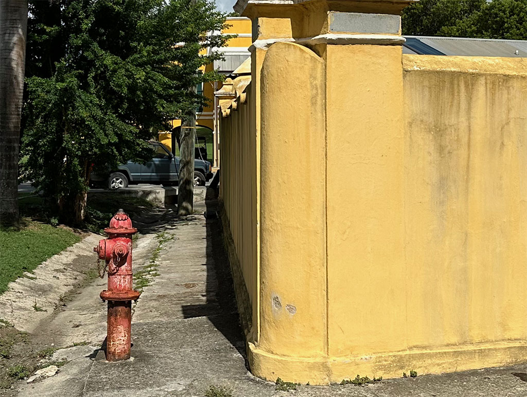
This is a view along the remaining segment of the north wall of the company yard, the background being the arch under the stairs of the Customs House, highlighting how the wall was truncated thus facilitating the building of the customs house.