
National Park Service: Historic Site
National Park Service: Foundation Document
Christiansted is a town known for its well-preserved architectural examples, showcasing Danish Neo-Classical, Renaissance Revival, and Danish West Indian vernacular structures. One of its notable landmarks is Fort Christiansvaern, a typical 18th-century fortification. Unlike many other historical towns, Christiansted has been fortunate to avoid significant physical damage from fires or hurricanes, maintaining the authentic scale and ambiance of a 19th-century West Indian port and market.
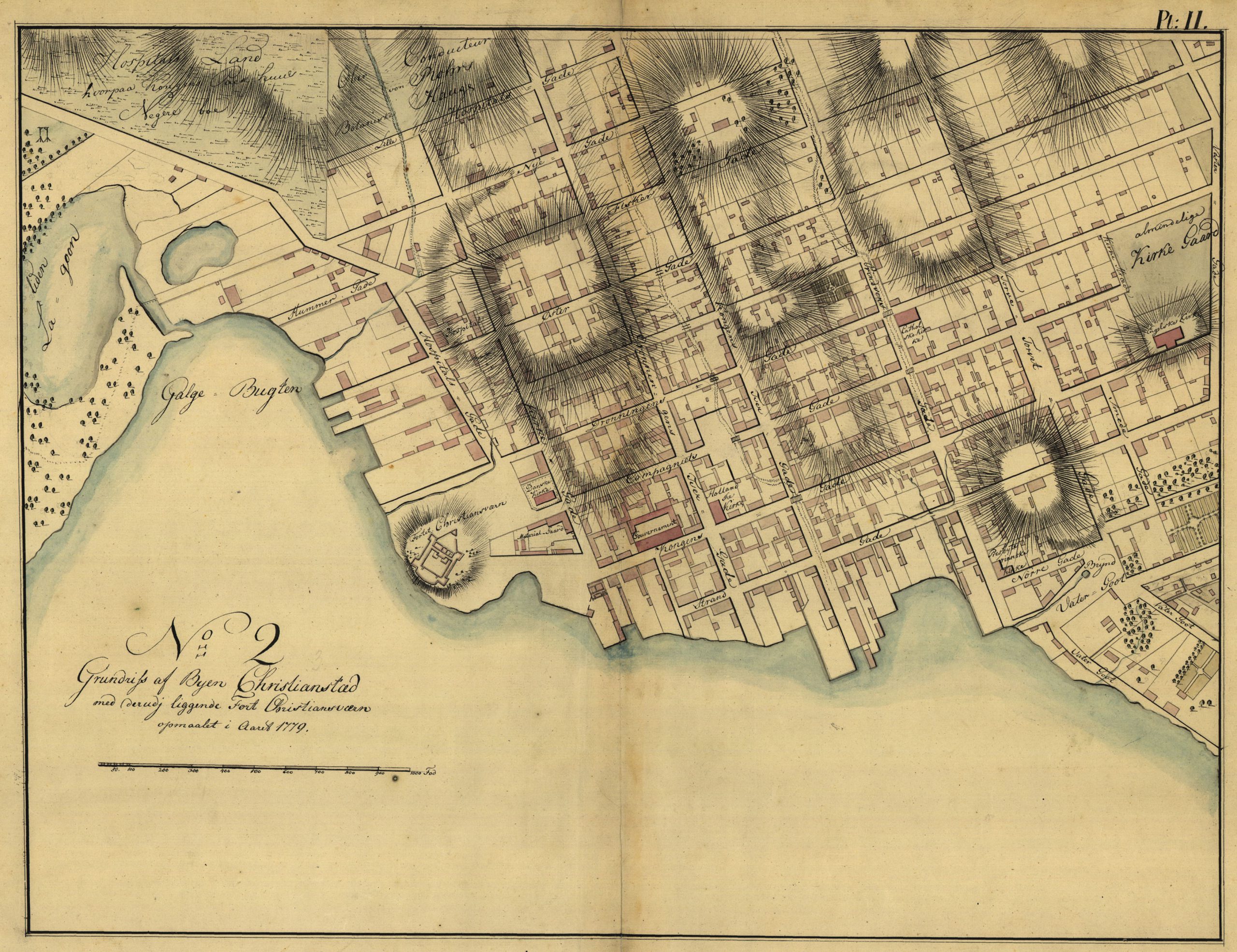
Founded in 1734 by Frederik Moth, the first Danish governor of St. Croix, Christiansted was established on the grounds of a former French settlement called Bassin. Moth meticulously planned the town by laying out streets, dividing it into building sites, constructing an earth fort for protection, and implementing strict building restrictions and codes. These regulations have contributed to the town’s charm and visual harmony that can still be appreciated today.
Christiansted experienced rapid growth in the late 19th century, mirroring the overall prosperity of the sugar industry. This expansion was further fueled by the town’s establishment as the seat of government in 1735, replacing Charlotte Amalie. The port thrived during this period, facilitating the shipment of numerous hogsheads of sugar essential for generating specie. This currency was crucial for settling plantation debts and acquiring imported luxuries
Before the French took over, Bassin was believed to have been a Dutch settlement that was contested by the English and Spanish. The conflict was settled in 1650 when the French military seized the area and later sold St. Croix to the Knights of Malta. Regrettably, Bassin did not thrive and remained a collection of rudimentary huts until Moth and the Danes arrived.
By 1800, the mercantile importance of the town peaked, with a population of 5,284. This number was somewhat boosted by wealthy planters who considered it fashionable to own a townhouse along with their grand house on the sugar plantation estate. Consequently, the town evolved into a thriving hub for plantation society.
The sugar industry started declining after 1820, leading to a stagnation in the town’s growth. In 1829, there were only 12 more buildings than the 664 that were present in 1796. The current development mainly extends to the west and has not affected the historical integrity of the town.
Government House:
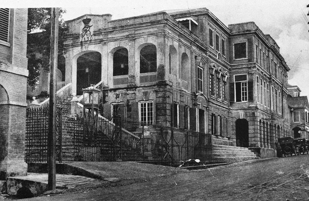
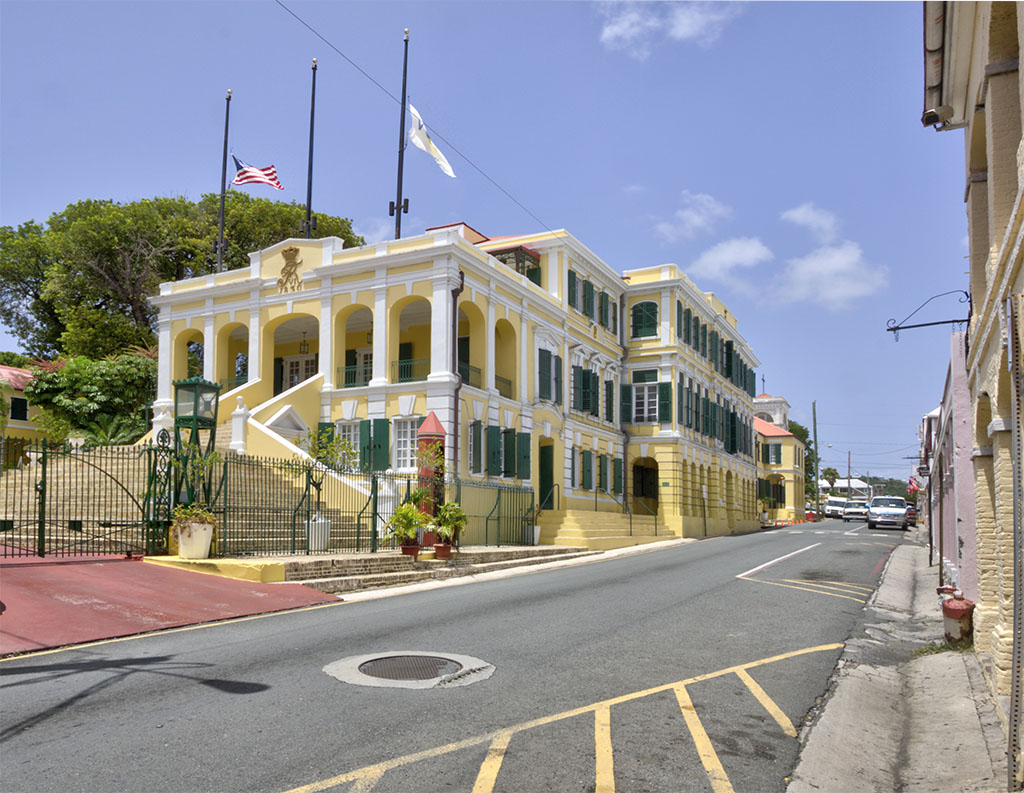
Government House is a significant three-story masonry building that occupies a quarter of a town block. It functioned as the Governor’s residence and the colonial government offices for the majority of the Danish era. The central section, built in 1747, stands out with its three stories and elaborate Baroque design. Additional wings were added around 1800, expanding the original structure. In 1830, a private residence from 1794-97 on Queen’s Cross Street was integrated into Government House, along with the installation of a grand staircase in the eastern section. The first floor of the central part features arcades, while the upper levels are distinguished by robust belt courses upheld by engaged pilasters with base and capital bands. The entire edifice is encircled by a molded cornice beneath a modest stepped parapet wall, crowned by a shallow pediment above the main entrance.
Scale House:
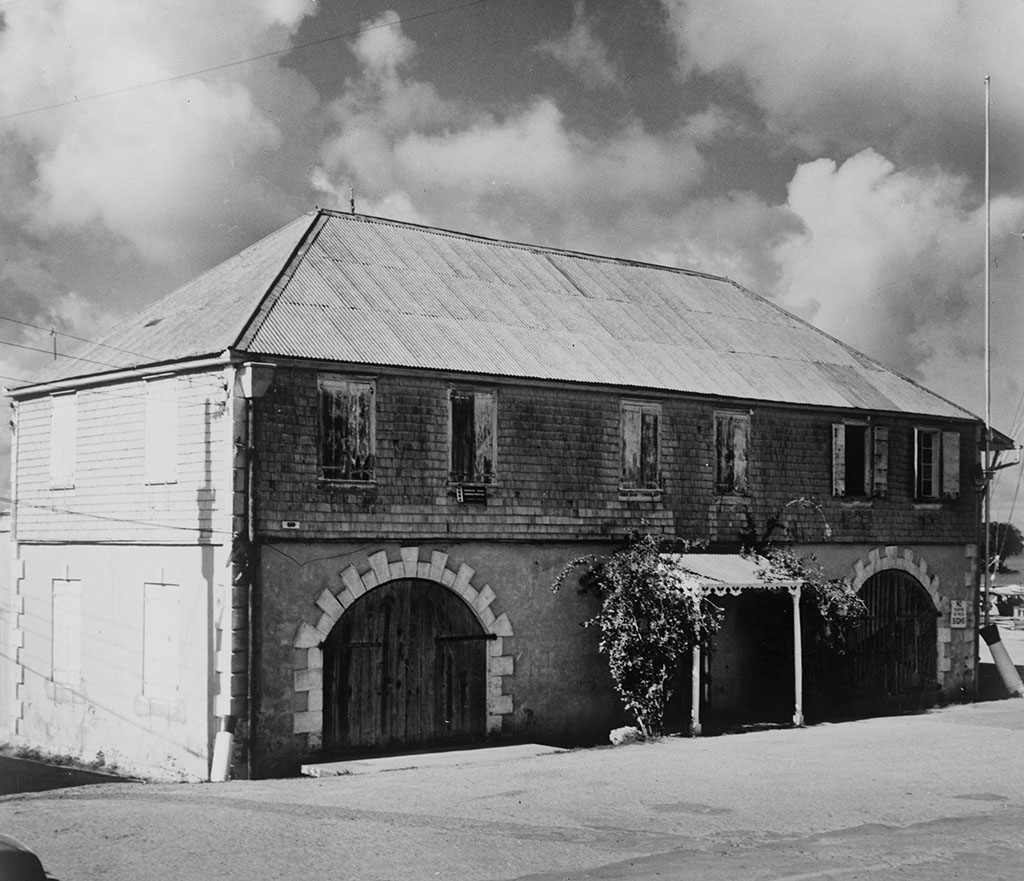
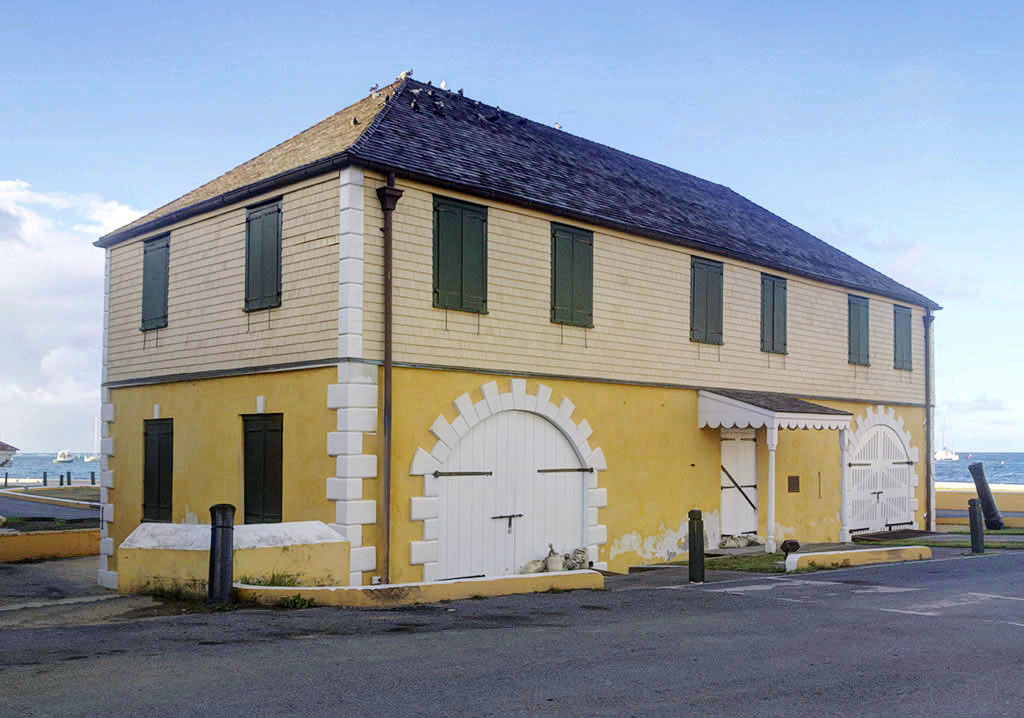
The current two-story Scale House, completed in 1856, is used for weighing imports and exports. It occupies a similar footprint to earlier structures and is situated on the wharf, allowing for the immediate tally and supervision of goods entering Christiansted. The first floor houses the office for the weighmaster and scale, while the second floor accommodates Danish soldiers initially and later harbor staff
Customs House:
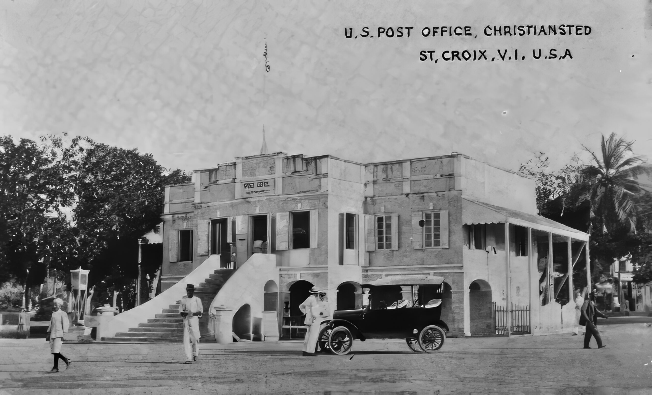
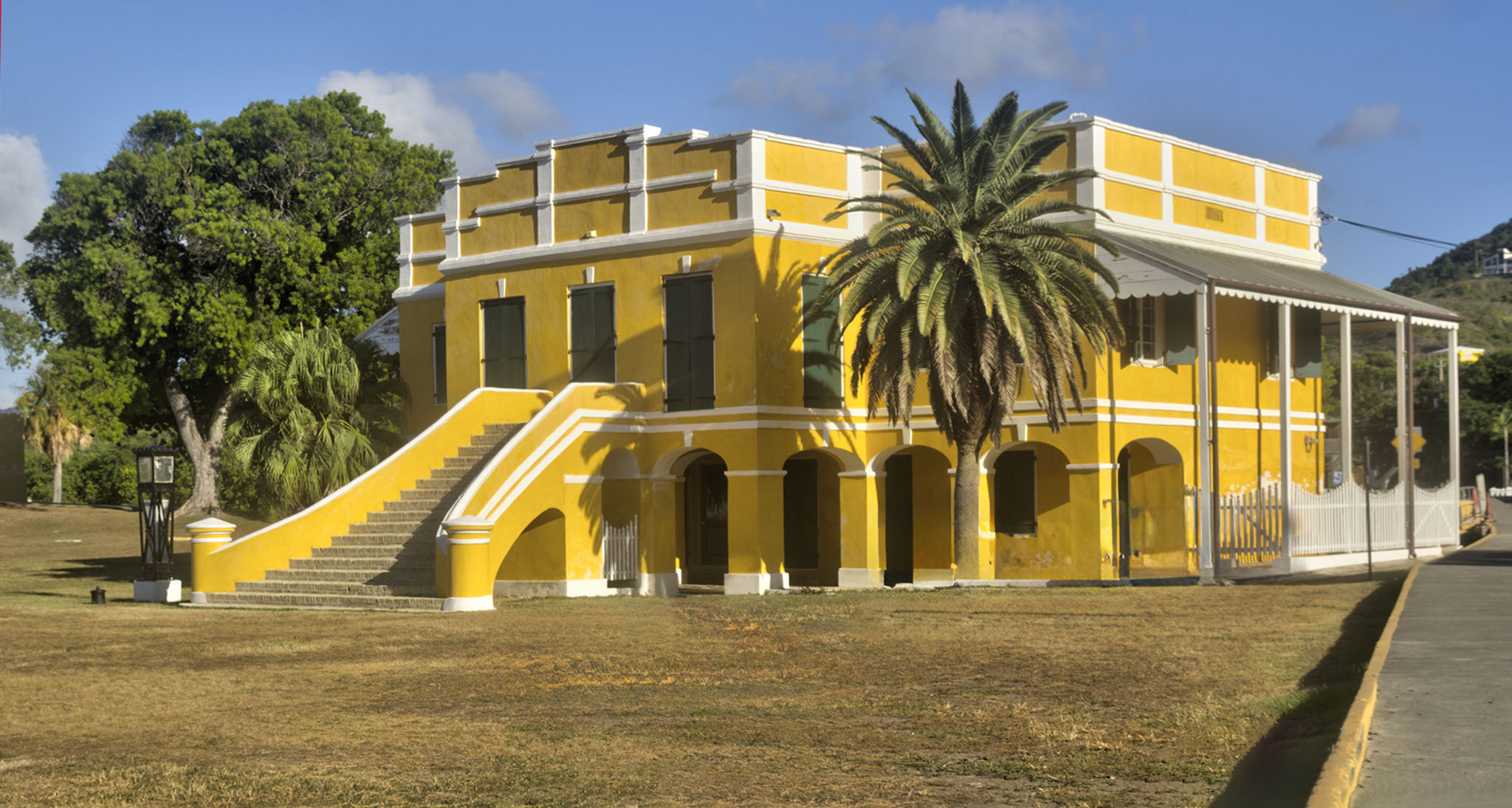
The Customs House was completed between 1840 and 1842 on a part of the site where a previous slave and sugar trading compound once stood. This compound had been significantly reduced in size after Denmark abolished the transatlantic slave trade on March 16, 1803, eliminating the need for such a large material yard.
The Danish government used this location for the collection of customs revenues. Situated between the wharf, Scale House, and warehouse, the Customs Service for St. Croix operated from this building until 1927. Subsequently, from 1926 to 1972, the building was repurposed as the first public library in the U.S. Virgin Islands and also functioned as a post office.
Throughout the 1980s, the first floor of the building housed the office of the Delegate to Congress, while the second floor operated as a library managed by the Bureau of Libraries, Archives, and Museums.
Steeple Building:

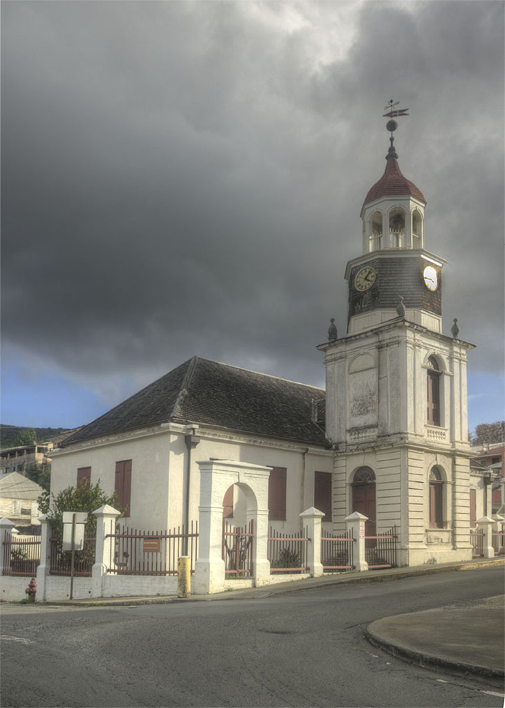
The “Steeple Building,” known for its distinctive Georgian steeple, was originally constructed between 1750-1753 by the Danish West India and Guinea Company as a Lutheran Church named “Our Lord of Zebaoth.” Initially, it was a simple one-story rectangular masonry structure with a low hipped roof. The iconic steeple that now defines the building was added during renovations between 1793-1796.
After serving as a Lutheran church for several years, the congregation vacated the premises in 1831, returning the property to the Danish government. Significant modifications were made to the building in 1841-1842, including the removal of the roof, extension of two walls, and lowering of the other two.
In 1961-1965, the National Park Service undertook a restoration project to bring the church back to its circa 1800 appearance. Today, the “Steeple Building” is an integral part of the Christiansted National Historic Site, preserving its historical significance for visitors to appreciate.