The earliest map of St. Croix is the du Tertre map from 1671. I had a copy of this map in my office for many years. Visitors were often surprised because, although they recognized it as a map of St. Croix, it was actually upside down, with the south coast at the top. This map first appeared in a significant journal called “Histoire generale des Antilles habitées par les Francois,” written by the French Dominican Blackfriar, Jean Baptiste du Tertre. Originally named Jacques du Tertre and born in 1610, he changed his name upon joining the Dominican order. The map itself was created by François de La Pointe and published by Thomas Jolly in 1667. François de La Pointe, also known as François de Lépine or Lespine, was a painter and engraver, but the source of the original cartography remains unknown.
Du Tertre Map (1671):
- Created by François de La Pointe and published by Thomas Jolly in 1667.
- Upside down orientation caused confusion among viewers.
- Provides essential details on geography, topography, water sources, and vegetation.
- Offers insights into French colonization and Carib communities on the island.
- Depicts Governor François DuBois’ mansion, headquarters of the Knights of Malta.
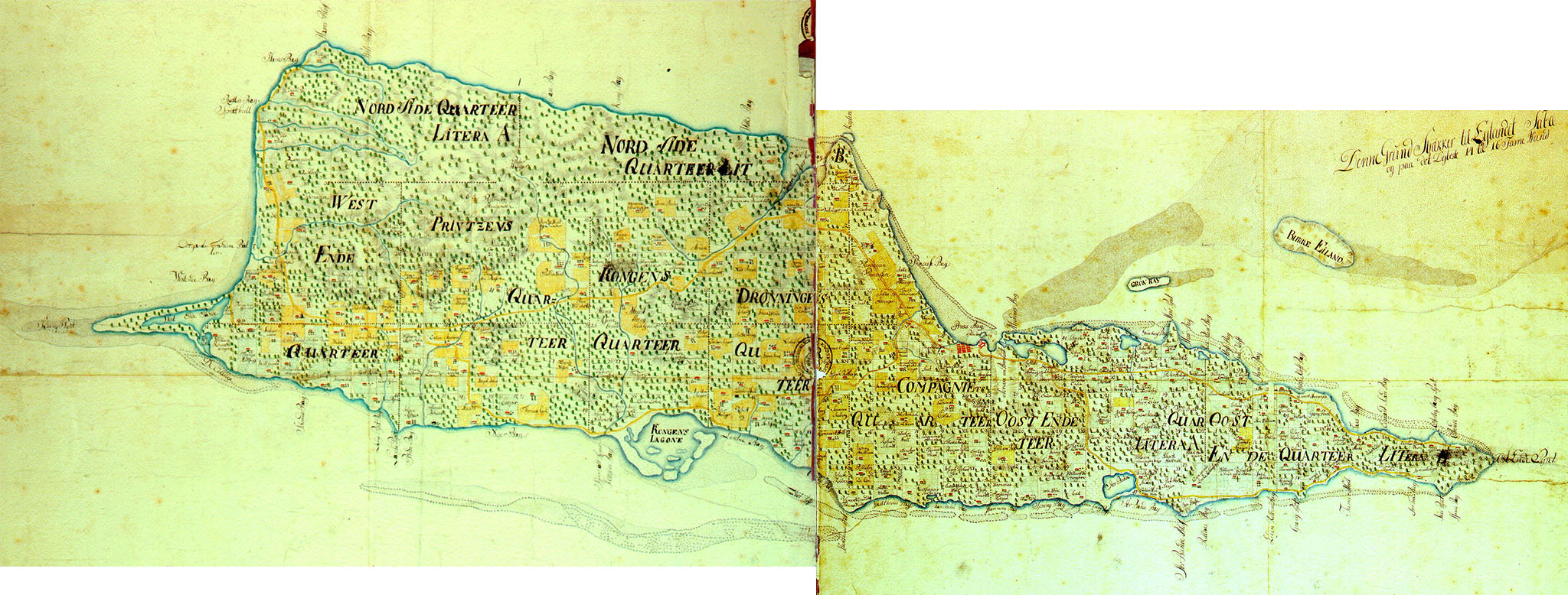
- Created by Johann Cronenberg and Johann von Jaegersberg.
- Commissioned by the Danish West India Company (1734-1754).
- Used to define quarters and estates, including the Center Line/Survey Line Road.
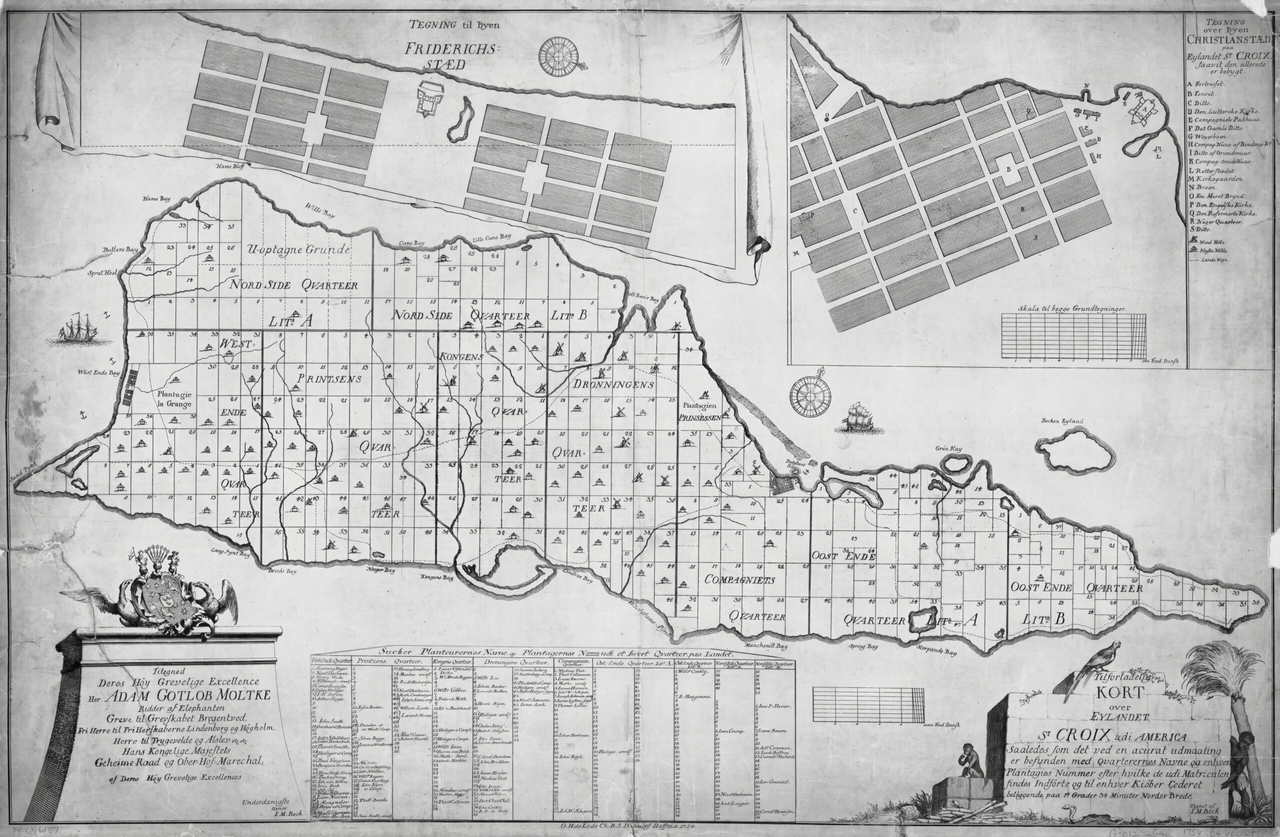
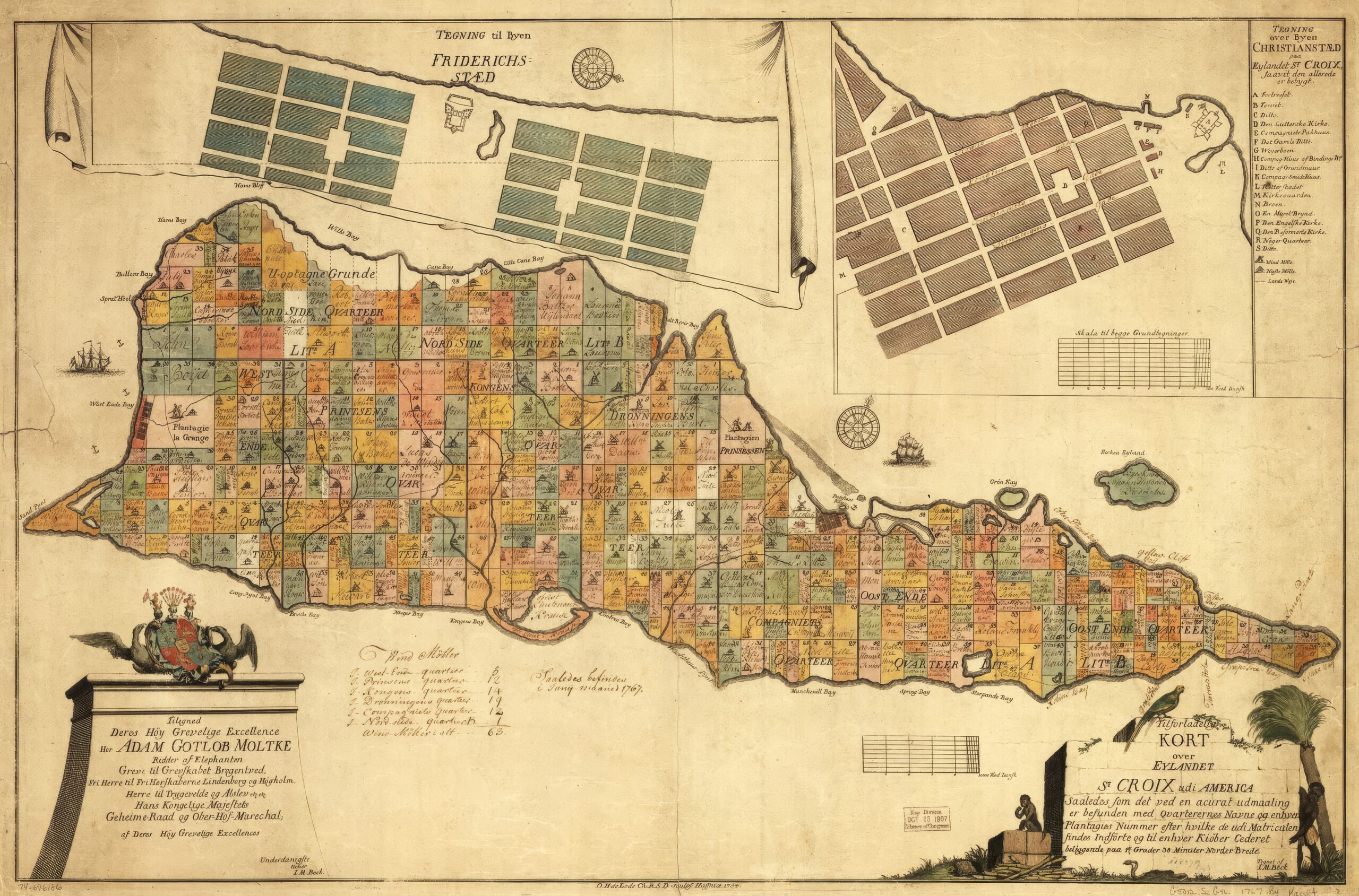
Beck Map (1754 / 1784):
- Created by Jens Michelsen Beck, a Danish surveyor and cartographer.
- Based on the Cronenberg Map, with improvements to the northern shore representation.
- Updated with additional annotations and colorized c.1784.
- Large (18MB) Map Image
- Large (6.6M) Color Map Image
Oldendorp Map (1767):
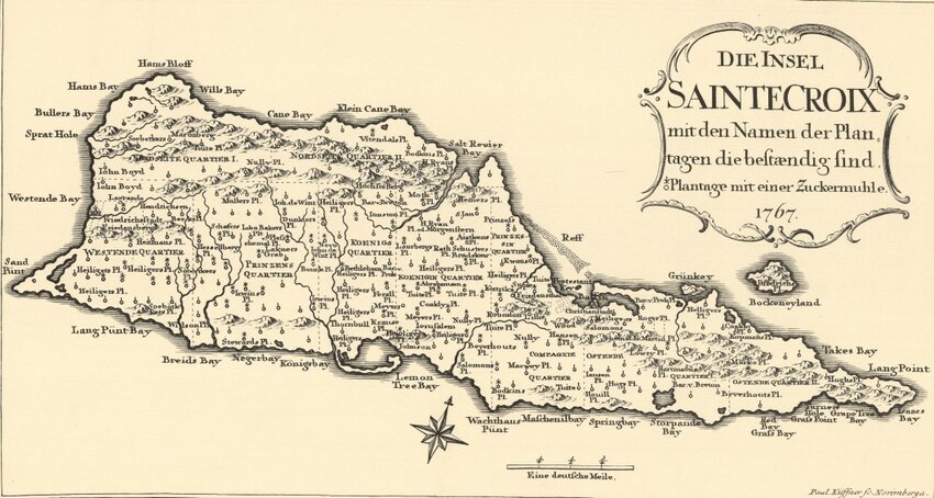
- Created by Moravian missionary David Zeisberger.
- Derived from the Beck map with German notations.
- Featured in Christian Georg Andreas Oldendorp’s report on the Danish West Indies.
These maps provide valuable historical insights into St. Croix’s development, early settlements, and geographical features. Additional specialized maps exist, such as marine charts and geological maps, enhancing our understanding of the island’s diverse landscape.