In a past post, I discussed how the island of St. Croix has been shaped by plate tectonics, with a focus on the Kingshill Marl. John T. Quin, in his book “The Building of an Island,” identifies three primary rock types that make up the island, though the geological composition is more complex than this simplified overview. Much of the information provided here is drawn from three referenced publications listed at the end of the page. Additionally, a fourth publication on geochemistry and mineralogy is included for those seeking a deeper understanding.
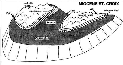
To generalize the formation of these three rock types, we refer to the diagram from Nagle and Hubbard. Initially, the Caledonian formation was deposited through undersea volcanic activity. As the island uplifted, volcanic ash and other materials settled along the boundaries, forming tuffaceous rock. With the cessation of volcanic activities, coral formations began in the seaway adjacent to the tuffaceous rock. Continued uplift caused the corals to rise out of the seaway, leading to additional coral growth and the eventual formation of Limestone Marl. This marl, lifted entirely out of the ocean, contributed to the creation of St. Croix as we know it today.
Whetten, in his paper “Field Guide to the Geology of St. Croix,” explains that the rocks underlying St. Croix’s mountain ranges (and likely those deep beneath the Central Valley) are sedimentary, formed from eroded volcanic debris and volcanic ash from an undersea volcano. These sediments were deposited on the deep ocean floor during the late Cretaceous period, about 80 million years ago. The limestone (or marl) at the surface of the Central Valley is much younger, dating to the Miocene epoch (approximately 20 million years ago), and likely represents the remains of a coral reef that formed as the island uplifted.
Nagle and Hubbard, in their paper “St. Croix Geology since Whetten,” describe St. Croix as segmented into different tectonic fragments. This segmentation is observed in other Caribbean islands such as Puerto Rico, Cuba, and Hispaniola, where correlating units across major fault zones is challenging. By the 1980s, it became evident that all these islands, including St. Croix, were part of a deformed collisional plate boundary that experienced initial compression, followed by transcurrent tectonics and extension.
Blue-Beach
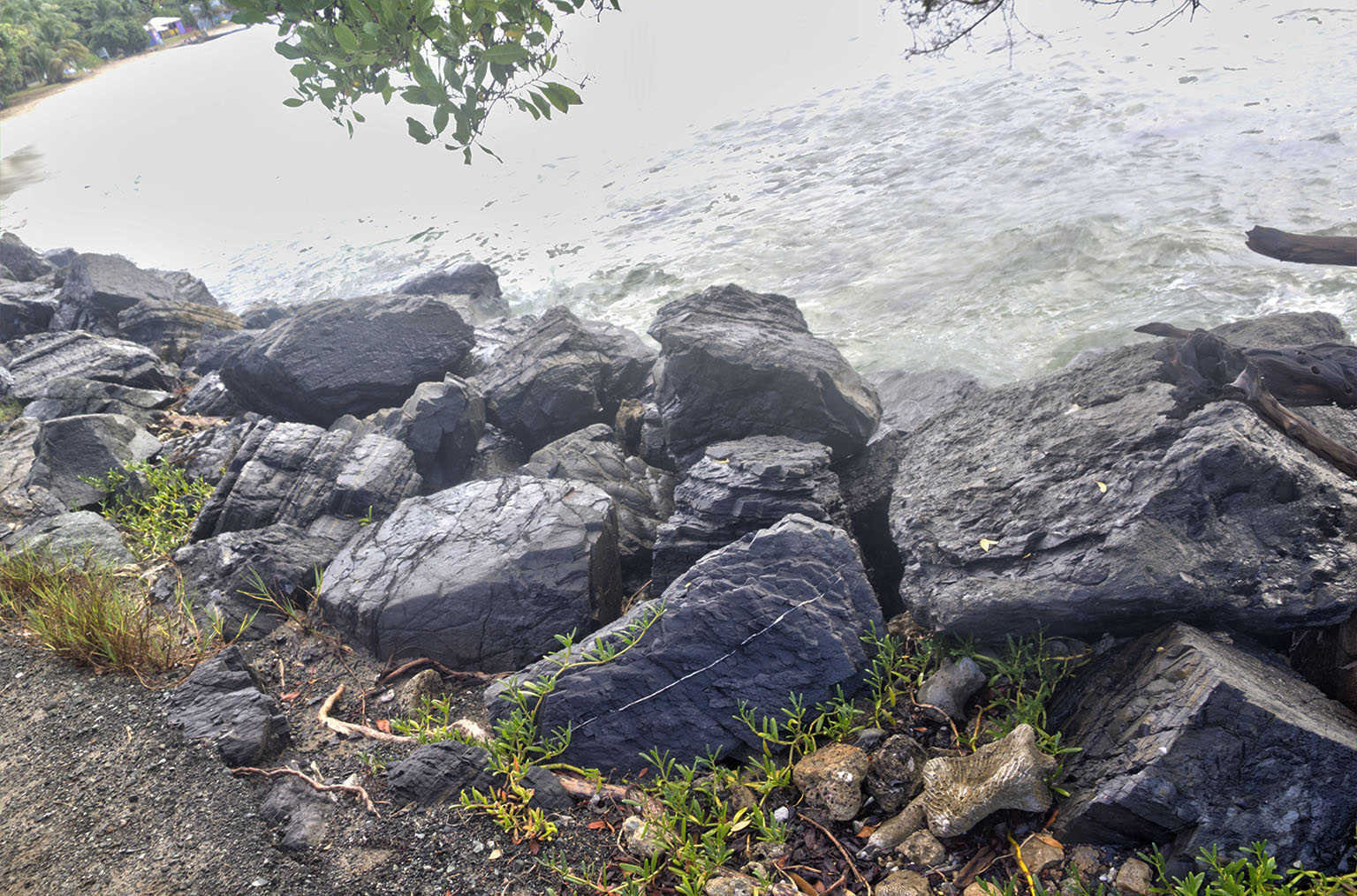
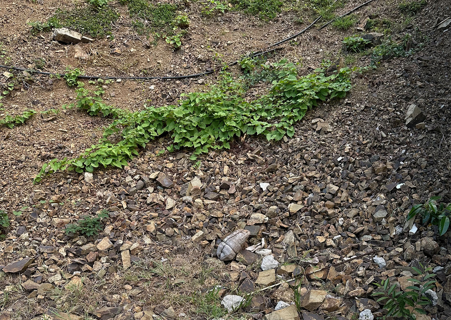
The examples of Blue-Beach were captured at the east end of Cane Bay Beach. The first one was likely placed there for erosion control, while the second one was rolling down the hill. According to the Generalized geologic map of St. Croix by Nagle & Hubbard, the rock originates from the Caledonian formation.
The Caledonian formation is found in the far northwest, specifically in the Hamm’s Bluff area, and in the far east end where Jack and Isaac’s Bay is commonly referred to as “Blue Beach.” Blue-Beach is a part of our daily drive route, as it forms the rock component of our road surfaces.
We drive on Blue-Beach every day as it is the rock component of our road surfaces.
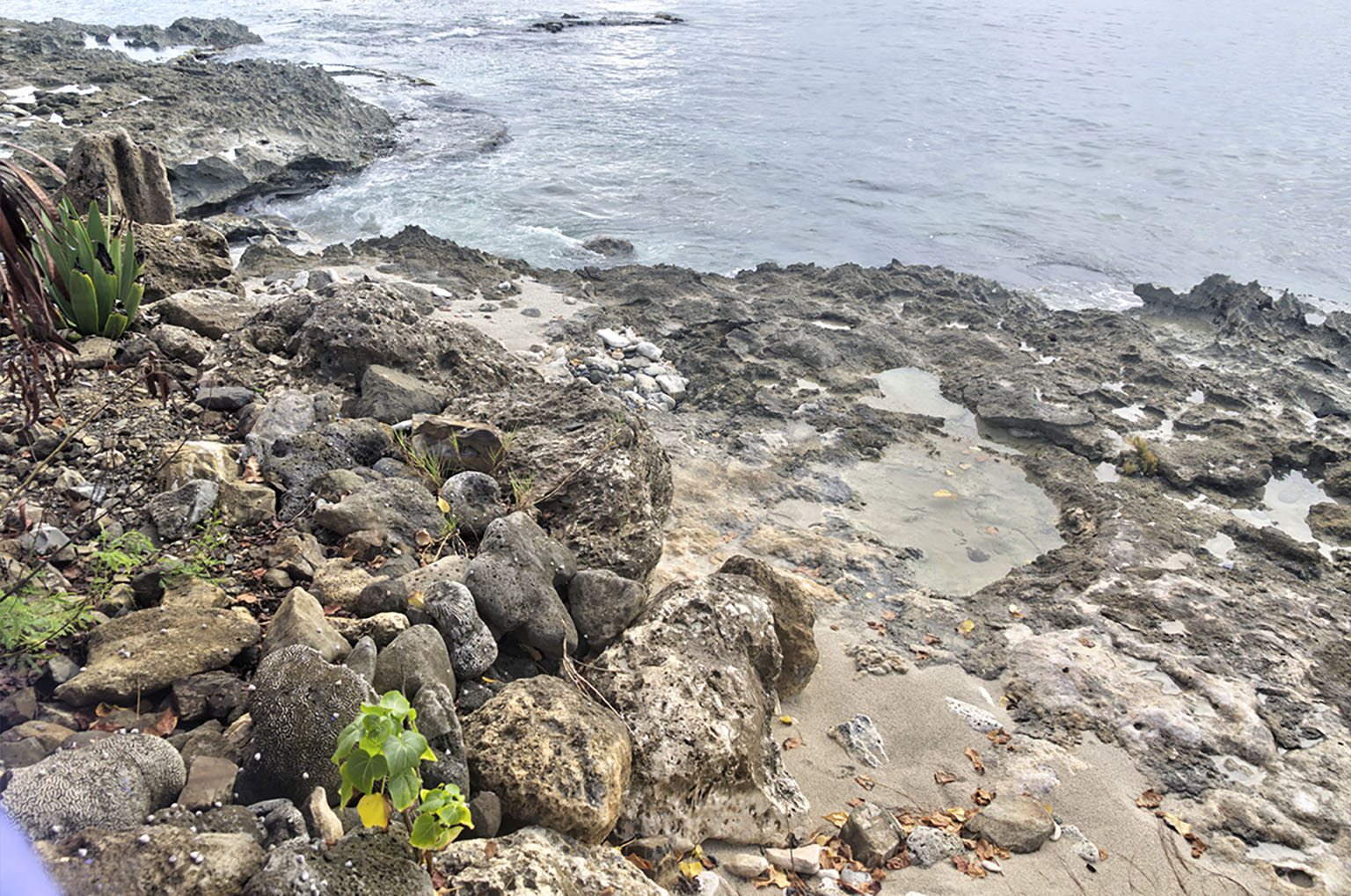
Limestone Marl
Some refer to this as “caliche,” but that is probably incorrect. Caliche is a sedimentary rock commonly found in arid regions. It is formed by the accumulation of calcium carbonate and other minerals in the soil over a long period of time. In this context, it appears as a layered rock, resembling “the remains of a coral reef” after uplift
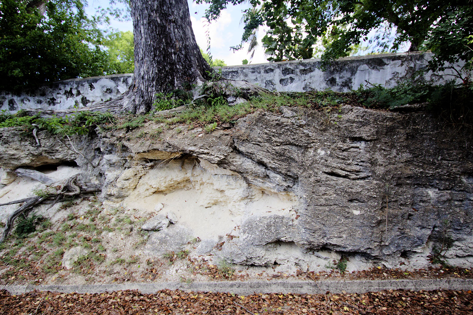
Rotten-Rock
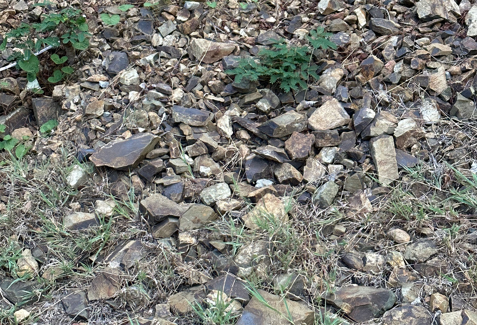
The examples of Rotten-Rock are located at Estate Peters Farm, next to the bypass, east of Peters Farm Road. This type of volcanic rock is notably friable in many areas, and steep cuts like this one often experience continuous slumping.
Rotten-Rock is formed from volcanic ash and other pyroclastic materials. A rock with 25% to 75% ash content is known as tuffaceous, while a rock with over 75% ash content is classified as tuff.
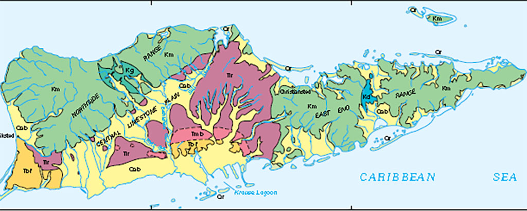
According to the Generalized geologic map of St. Croix by Nagle & Hubbard, the tuffaceous rock stretches north-south across the Christiansted neck and east-west from Salt River to nearly Frederiksted.
In this diagram from Nagle/Hubbard, we see what Quin refers to as the “Northern Hills” and the combination of the “Christiansted Hills” and the “Eastern Triangle”, comprising the Blue-Beach and Rotten Rock, and the southwest to northeast “seaway” of Quin’s Kingshill Marl before the island uplift.
The Admiralty Chart of 1874 gives a far more detailed representation of this concept. Caution: this is a very large file (2.8MB) and will open in a new tab. Larger sizes (up to the original 23,688 × 15,847 pixels : 40.25 MB) are available for study from Wikimedia Commons
The map shown here is from a paper, Geology and Hydrogeology of the Caribbean Islands Aquifer System of the Commonwealth of Puerto Rico and the U.S. Virgin Islands, presented in 2002 by R.A. Renken, W.C. Ward, I.P. Gill, F. Gomez-Gomez, J. Rodriguez-Martinez.
- The Building of an Island: being a sketch of the geological structure of the Danish West Indian island of St. Croix, or Santa Cruz (pdf from the Internet Archive: a non-profit library of millions of free books, movies, software, music, websites, and more.)
- Author: John T. Quin
- January 1907
- FIELD GUIDE TO THE GEOLOGY OF ST. CROIX, U.S. VIRGIN ISLANDS
- Author: John T. Whetten
- 1966
- St. Croix Geology since Whetten: An Introduction
- Frederick Nagle; Department of Geological Sciences, University of Miami
- Dennis K. Hubbard; West Indies Laboratory, Fairleigh Dickinson University, St. Croix
- Digitized 2004
- Geochemistry, Mineralogy, and Geochronology of the U.S. Virgin Islands
- HENRY V. ALMINAS and EUGENE E. FOORD, U.S. Geological Survey
- ROBERT E. TUCKER, U.S. Army
- 1994